
To explore Arncliffe, cross the road and take the path opposite, which emerges by the bridge. Cross the bridge and follow the road to the village green.
| Map: | Sheet 30 Yorkshire Dales - Northern & Central areas |
| Start: | Kettlewell National Park car park (SD 967722) |
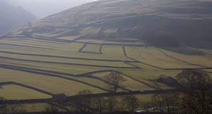
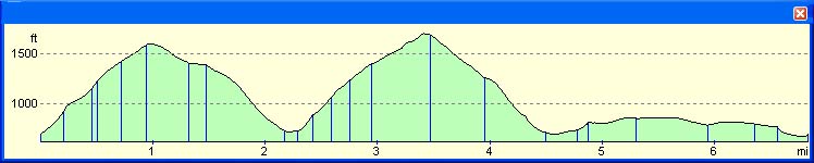
| Route: | The route climbs from one valley to the next, then back over the ridge and finally following contours above the Wharfe. Most of the route follows clear paths or bridleways. |
|
From The car park, turn right on to the road, walking away from the village to cross the bridge. There are two paths to the right of the road - follow the one which climbs, more steeply up the hillside. Follow the sign, "Bridlepath Moor End, Footpath Arncliffe." Then follow the footpath signposted to Arncliffe, which bears to the left up the side of the valley. | |
|
|
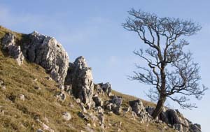
Continue to walk uphill, passing outcrops of limestone, eventually reaching the ridge. The path descends into Littondale crossing
the open fellside. Eventually the path enters Byre Bank Wood, where there is a steep scramble down, before the path levels out a little.
After leaving the wood, the path drops down to the road.
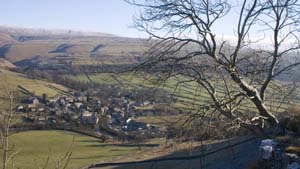
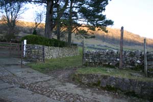
To explore Arncliffe, cross the road and take the path opposite, which emerges by the bridge. Cross the bridge and follow the road to the village green. | |
|
Leave the village by re-crossing the bridge, but stay on the road until you come to a T junction. Here, take the path ahead. The path leads round the left of a wood, then joins a bridlepath. Turn right onto the bridleway | |
|
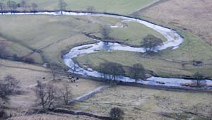
The path takes you north across Brayshaw Scar, then turns north east, crossing open moorland, up to the ridge. The slope downhill is reasonably gentle until the trees are reached. It is then quite steep for a short distance, until you arrive at the riverside meadows. | |
|
Continue along the path, across the bridge and on to the road at Starbottom. We turned left, and walked along the road to the Fox and Hounds for a refreshment stop. | |
|
We retraced our steps along the road, then followed a footpath which left a side road at the southern end of the village. The path climbed a little way up the hillside, then followed the contours along the hillside, before descending to Kettlwell. |
Back to:
Walks Index
Graham's gallery of photographs -
Yorkshire Dales page
Graham Dean's Home Page