Map: Sheet 2 Yorkshire Dales - South and West
Start: Burnsall - SE033612 (two car parks and limited road parking)
A gentle stroll, through fields and along the river.
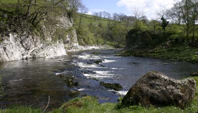
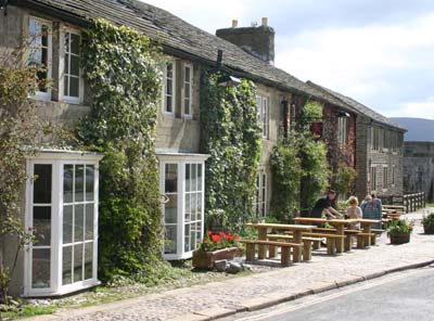
Before setting off we had a morning coffee sat in the sunshine outside the Red Lion. The footpath heads north, between the Red Lion and the river. The surface of the path along the first stretch has been made suitable for wheelchair users. In less than half a mile the river cuts through a narrow gorge, with Wilfrid and Loup Scars on the eastern bank.
The valley widens, and the path crosses the river - either by footbridge or stepping stones. Once across, take the path which leads away from river. At the junction with the minor road, turn right, then take the first footpath on the left (fingerpost Hebden and Bank Top). The path leads between between two gardens, then meets two paths from the right. Follow the fingerpost for Hebden, and stay close to the stream. Whne you can see the village on the left, take the first path leading up to the road. Turn right along the road, then left at the cross roads.Refreshment is available at the Clarendon Hotel.
Walk along the road, past the Clarendon Hotel, and follow the second finger post on the right (Grassington via High Lane). This path crosses a large number of fields, the path is not always clear on the ground, but the stile or gate is usually clearly visible across each field. One which isn't clear is just before you enter a narrow band of trees - here the stile is tucked in the corner. The path crosses a drive way and then there is a length where it is paved, to prevent damage to the meadowland.
Continue, following finger posts, until you reach the enclosed High Lane. This track emerges at the top end of Grassington. Turn right, then left, to walk down Grassington's main street, with its choice of pubs and tea rooms.
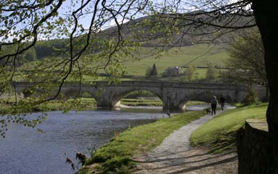
 At the bottom of Grassington's main street, turn left and follow the road to the car park (on right). Cross car park and go through gate to Sedber Lane. Follow the lane to the river and Linton Falls. Don't cross the river, but take the downstream path, which stays close to the river (it does leave the river for a few hundred yards, avoiding the sewage works). On arriving at the suspension bridge or stepping stones cross the river, then re-trace your original route to Burnsall.
Back to:
Walks Index
Graham Dean's Home Page