Map: Sheet 2 Yorkshire Dales - South and West
Start: Clapham National Park Pay and Display Car Park (Grid ref:746692)
A walk mostly along green lanes and clear field paths.
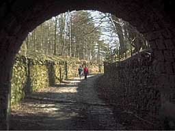
Turn right at the car park entrance and walk up the village street towards the church. Immediately before the church take the bridlepath on the right. This passes through two short tunnels below the Ingleborough Hall Estate. Continue along this track until the end of the woodland, where you take the track on the left (Long Lane).
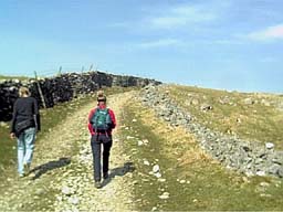
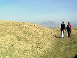
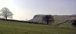
Just over a mile along this track look across Clapdale to see the entrance to Ingleborough Show Cave. About half a mile beyond the cave, the track is no longer enclosed by walls. There are various tracks ahead, but take the rightmost one (see 3rd photograph). At a further junction of tracks (near the corner of a boundary wall) again take the right hand track - heading for a cairn. This cairn marks the highest point on the walk.
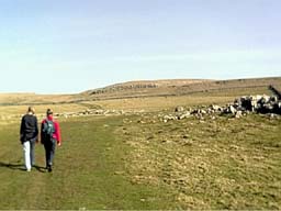
On a clear day the view ahead is impressive, across a large area of limestone pavement to the squat Sphinx like shape of Pen-y-ghent. Take the first path on the right and head down towards the farm buildings at Crummack.
Turn right along the track by the farm, passing through two gates. As you follow this enclosed track (Crummack Lane) you will notice a large number of darker coloured boulders in the fields on the right. These are erratics, deposited by glaciers in the ice ages. Shortly after the track becomes surfaced, look out for a finger post on the left. Take the stile on the left a few yards past this (or for a closer look at the so-called Norber erraticstake the stile on the opposite side of the road). Follow the path downhill, heading for a stile to the right of a filed barn. Continue to next stile to cross Thwaite Lane.
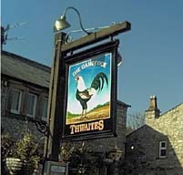
Cross the final field before entering the village of Austwick. The footpath takes you ahead, through a garden, before joining the road. At the road junction turn right, and walk through village. We paused for refreshment at the Gamecock Inn.
Just before leaving the village, look out for a finger post pointing over a stile on the right. It says Clapham is 2 miles away - it's not that far - honest! Follow the path which takes you through fields which show the terracing produced my medieval strip farming. Cross a number of stile (most of the walls have ladder stile next to the original stone steps built into the wall. As you near Clapham, the stiles are replaced by kissing gates.
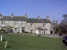
As you approach Clapham, the footpath is enclosed between two barbed wire fences, at the right of the farm track. Look out for the stile which enters the car park. If you need refreshment, the nearest place to the car park is Anne's Cafe. We enjoyed mugs of coffee, and also the opening times notice on the door:
Hello!
I am open
Never - Mondays and Tuesdays
Sometimes - Wednesdays
Often - Thursdays and Fridays
Always - Saturdays and Sundays
Back to:
Walks Index
Graham Dean's Home Page