| If you are starting from the A40, follow the unclassified road which leads north east, approximately
half way between the Nag's Head and the Farmer's Boy. Walk under the disused railway bridge and up to Old Farm.
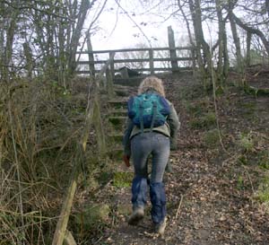
Turn right, following the track with the no through road sign. From this track, climb steps on right to cross stile.
There are shortly more steps leading to another stile. Then turn right in field at waymarker, through a small group of trees.
Follow the path round to the left, then crossing three fields, keeping the field boundary on your right. Close to May Hill Farm
climb a stile, and follow the field boundary (now on your left) to the next stile, and a minor road.
|
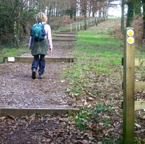 |
Turn left onto the road, then right, following waymarkers and National Trust sign post. Climb shallow steps through woodland, to reach a
gate leading to access land. Continue across the open land to trees at summit.
|
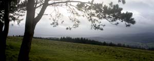 |
This photograph (looking south east, across to the River Severn) does little justice to the magnificent views in all directions from the
to of the hill.
|
 |
Walk south east, between gorse bushes, to woodland on left.
Go through metal gate, along track, past metal pole barrier, to cross minor road.
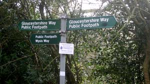
Where path branches, take left hand fork, signposted Wysis Way.
Follow narrow path, passing through narrow concrete posts to emerge at the end of a road.
Follow footpath sign to enter woodland by crossing style. Almost immediately the path forks - follow the path on the right.
On the day we completed this walk, this path was extremely muddy.
The path continues downhill, through woodland, to emerge on the road at Glasshouse.
|
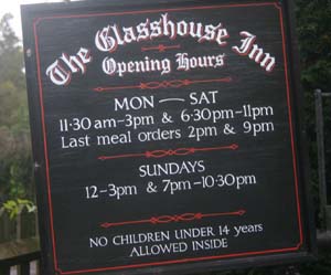 |
Turn right on to the road. We stopped for refreshment at the inn - but not for too long, as rainclouds were gathering.
|
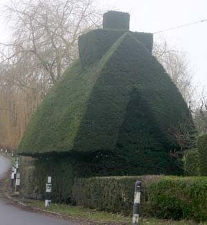
| There is interesting topiary, both at the inn, and across the road from it.
To avoid futher mud, and to try to arrive back at our
self-catering cottage before the rain set in, we returned mainly along roads. From Glasshouse we followed the sign for May Hill.
We continued along this road, ignoring the roads and tracks which would have taken us through May Hill village.
|
|
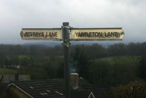 |
At the first crossroads, we turned right along Yartleton Lane. This climbs gently until just beyond May Hill House, then levels out.
When we arrived back at the stile on our left waymarked for the Gloucesetershire and Wysis Ways, we retraced our steps described in the
first section.
|