Based on a walk from a National Trust leaflet, Walk on the Long Mynd, 2 Cardingmill & Townbrook.
Map: Explorer Sheet 217 - The Long Mynd & Wenlock Edge
Start: Car park in Cardingmill Valley, just below National Trust Chalet Pavillion - SO444944 (alternatively, pay and display car park off Corve Street, near railway station)
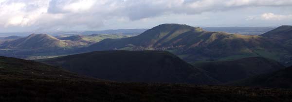
A walk which includes steep hills, but provides impressive views.
From wherever the car park, walk up the road to the Pavillion. Just beyond the Pavillion, cross the footbridge and follow footpath. Shortly after the path re-joins the road, cross over, and cross the footbridge on the left. This path takes you up to New Pool reservoir.
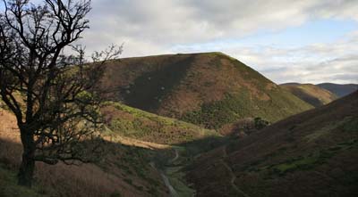
On reaching the dam, turn right in front of the fence, and then right again, almost doubling back on yourself. Admire the view in front of you, as the high path curves left around the hillside, staying more or less level, to re-join the road. Cross the stream, and turn lrst, following the right bank of the stream up Light Spout Hollow. The path brings you to Light Spout waterfall
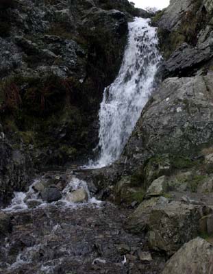
Climb the roughly stepped rock to the right of the waterfall, and keep walking on the right of the stream, until you come to the first tributary above the waterfall. Cross the stream, an stay on the right of the tributary. The path became unclear across the heather moorland, but a finger-post at a road junction should be visible to the left. When you reach the road, turn left, and at the junction, follow the road signposted Church Stretton(left).
Shortly after the junction, there is a path which runs parallel to the road on the left. This eventually rejoins the road, which needs to be followed for a couple of hundred yards to a small car park on the right. From this there is a path which leads into Townbrook Valley.
Before the path crosses the stream, turn sharp left down the path which runs between the stream on the right and Burway Hill on the left. After just less than a mile, at the far end of a reservoir, take the path on the left, which skirts woodland. Cross the road, and follow the track back to Cardingmill Valley, which emerges opposite the car park.
Back to:
Walks Index
Graham Dean's Home Page