Map: Sheet OL24 Peak District - White Peak area
Start: Alsop Station Car Park on the Tissington Trail (off A515 - SK166549)
This walk was very muddy in places - though we did complete it at a time when there were 80 flood warnings in place - and the River Dove had burst its banks, making nearby footpaths along the valley floor impassable!
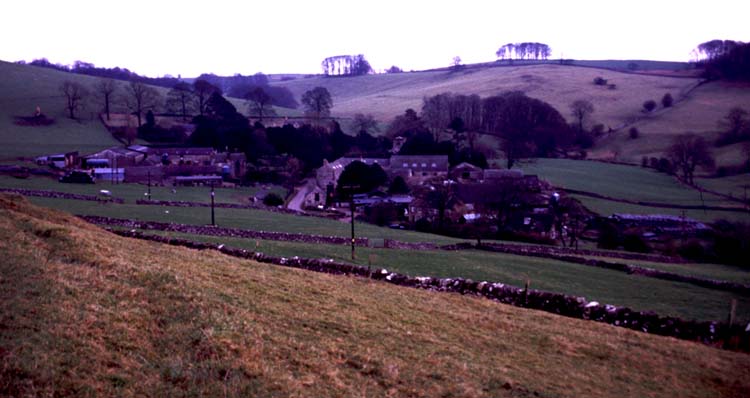
From the car park head north in the direction of Hartington. After only a few metres, follow the public footpath sign taking you down a steep hill on the right. Half way down the field cross a stile on the right. The footpath continues downhill, close to the fence. Turn right along the minor road, which leads through the hamlet of Alsop-en-le-Dale (pictured below). Notice the Manor House on your left and the Norman church on the right. We actually completed this walk whilst staying at Church Farm Cottages.
As you leave the hamlet, follow the footpath on the left, up across the field, to a stone stile. The path cuts across the corner of the next filed to another stone stile with a footpath finger post. Cross this stile and follow the path along the wall. The path takes you through a small area of low woodland, through more fields, across the drive to Peakway to re-join the road.
After about 50 metres there is another path which lead directly to Parwich - however, we continued to follow the road, allowing most of the mud we had collected on our boots to drop off before entering the village!
At the road junction, turn left for the village shop (unbelievably well-stocked), or right for the village pub (The Sycamore).
Leave the village by walking back along the road signposted for Alsop. As you leave the village, pass a farm entrance on the left, take the signposted path down to a stream on the left, then walk diagonally up a field and over a stile. When you leave the next field, there is a very short stretch ahead, along a very muddy, enclosed track. Cross the stile and turn left, following the signposted path. Cross two field boundaries, then head diagonally downhill towards a wooden footbridge. Cross the bridge, and follow the path directly uphill. At the top of the field the path zig zags to a stile by a gate. Cut diagonally across the next field to a finger post. The path to the join the Tissington Trail slopes gently down to the left. Turn right - from here it is a straightforward walk along the disused rail trackbed, back to the car park.
Back to:
Walks Index
Graham Dean's Home Page