Three days (one full day and two half days, to be more precise) strolling in the Peak National Park, starting at Hathersage railway station, finishing at Edale Station with overnight stays in Eyam and Castleton
Maps: Sheet OL1 Peak District - Dark Peak area and Sheet OL24 Peak District - White Peak area
Start: from outside Hathersage Station (SK232810).
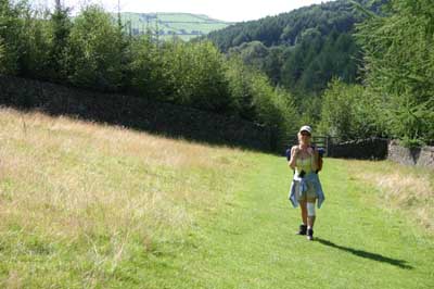
We left the station, turning left to leave the cul-de-sac. This meets the B6001, we turned right, so that we could explore the village, and have an afternoon tea, before walking. Anyone more eager to get started could turn left, and walk down to Leadmill Bridge to re-join our route.
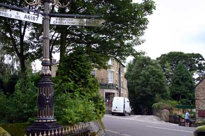
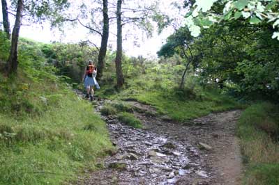
After wandering around the village, and having the required refreshment, we walked down the unclassified road which leads south from the road junction pictured above. About 200 metres after crossing under the railway, we climbed a substantial stone stile to the right of a wooden gate. The footpath follows field boundaries and emerges on the B6001 just to the north of Leadmill Bridge
We walked down the road, over the bridge to pass a pub on the left. At the next road junction, we followed a footpath which ran uphill, next to the unclassified road. The footpath rejoins the road just before farm buildings. We followed the road uphill, then as the road took a hairpin turn to the left, we followed a track which lead straight ahead (west).The track skirted the contours, before dropping as it entered Brook Wood.
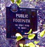
At a junction of paths, we turned away from Highlow Brook, following the signed path heading for Abney via Stoke Ford. 
At Stoke Ford, we followed the path south, signed for Grindleford and Eyam.
After only a few metres, the path divides, and we took the left hand fork.
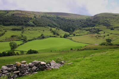
The path climbs quite steeply, but the views obtained above the gritstone outcrops. After the steepest section of the hill, the path crosses a field boundary and divides into three. We followed the middle route, along a well-used path across a field of heather. The path skirts to the east of a transmitter mass which sits on the summit of Sir William Hill before emerging at a road. We crossed this and walked downhill to meet another road. The path continues to the left, crosses two fields before entering a small wood.
We emerged from the wood, and turned right to follow the road through Eyam. If we had known where our accommodation for the night was situated, we would have been better turning left on the road, and taking either of the paths on the right. The path heading south east would have brought us to the end of a short road leading to The Water Lane and the Miner's Arms. Even though we had taken a longer route than was needed, we spent a comfortable night at the Inn, and enjoying a tasty evening meal and a hearty breakfast.
We left the village, retracing our steps, walking west along the road, past Plague Cottages and the church. Opposite Eyam Hall, we walked down the road, passing the car park for hall visitors. At a T-junction, a narrow path lead us straight ahead between houses. The path emerged at a road, crossed a small field ahead, then another road. The path continued across more than a dozen fields, but was always clear to follow. A couple of hundred metres before Foolow, the path branches, and it really doesn't matter which branch you follow. We took the path to the right, turned left on to the road, then right at the first road junction.
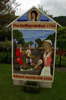
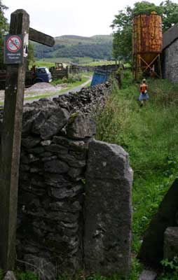
The road curves left through the village, and about 200 metres after passing the last buildings there is a path, marked with a finger post, on the right. The path crosses three fields, before becoming an enclosed track. Where the track met a road, at Grindlow, we turned right, and followed the road through Great Hucklow. Here we were disappointed that the village pub wasn't open for morning coffee, but delighted to see our first "dressed" well.
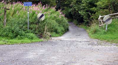
On leaving the village, a road joins at a sharp angle from the right. The track pictured below leaves this road close to the junction. We followed this track passed disused mine workings. Where the track forked by a metal gate, we followed the right hand track. The path continues for about a kilometre to pass Quarters Farm, then about another half kilometre to join the B6049.
 We turned right, to walk north along the road.
Between farm buildings we turned right along the path shown on the left below. The path across the field is unclear on the ground, but goes to the east of the hilltop tumulus.
We turned right, to walk north along the road.
Between farm buildings we turned right along the path shown on the left below. The path across the field is unclear on the ground, but goes to the east of the hilltop tumulus.
We walked downhill, to where the path left the field, and joined the road through Bradwell Hills. We climbed down steps on the right and re-joined the B6049.
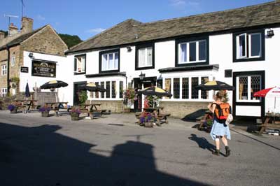
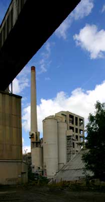
The pub in Bradwell was open - so we sat out in the sun to enjoy some much needed liquid refreshment. Just beyond the village school, we took the unclassified road ahead, whilst the main road veered to the right. At the next road junction we crossed the road and followed the bridlepath sign directly ahead. This wound between large quarry workings on the left (which weren't visible) and the cement works on the right (which certainly is visible).
 The path emerges on an unclassified road which leads into Castleton, where we sampled a cream tea before going to find the accommodation we had booked.
There are no photographs to illustrate the final day - it rained continually - however we still decided to carry on with our planned route, rather than walk straight over the ridge to the railway station.
We walked along the main road leading west from Castleton. Before passing the last houses, we followed a finger post on the right. After about 0.75 miles we came to the disused surface workings of Odin Mine. National Trust information boards helped interpret the site. We walked up to the road, where there were more interpretation signs, then followed the road to a hairpin bend. This road has repeatedly slid down the hillside, and the local authority has abandoned repairs, again information boards explain the geology of the slope below Mam Tor. At the hairpin bend, we followed the path on the right, which leads uphill to Hollins Cross.
We followed the ridge for about half a mile, before taking a path downhill on our left. This took us down to Backtor Farm, across Backtor Bridge, to an unclassified road. We turned left to walk aalong the road for about half a mile. A track on the left lead us over a railway bridge to the hamlet of Ollerbrook. We took a path on our left which brought us out to a footbridge, and then into Edale. We turned left and followed the road down to the station.
Back to:
Walks Index
Graham Dean's Home Page