| Map: | Sheet 287 West Pennine Moors |
| Start: | Spring Hill Picnic site, Whalley (SD740360) |
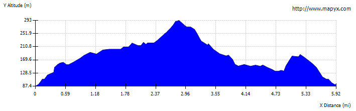
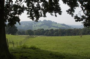
| Route: | The route includes field paths, farm tracks and unclassified road. Although paths taken don't cross the highest point of the hill, there are fine view. After wet weather some stretches will be very muddy. |
| More info: | More about Pendle from
Wikipedia. Lancashire County Council's information about Spring Wood. |
| Parking: | Spring Wood picnic site car park. |
| Buses: | Visit North West Journey Planner |
| Refreshments: | Despite being show on the latest OS map, there was no longer a pub in Wiswell. We could have detoured to the Wellsprings Inn from the Nick of Pendle, but settled for an ice cream from that van at the car park when we returned. |
|
|
|
Walk towards the car park exit, then turn left by the ice cream van. If its not there, look
the concessionary footpath sign. Cross the stile onto the golf course and walk up hill,
keeping close to the wall on the left. Aftaer about 220 metres leave the golf course by crossing
narrow stone bridge over stream on left. The large field was in the process of being subdivided by wire and post fences, so thaere are more field boundaries thanindicated on the OS map. Cross a stile, then continue between fences, then to right of them. Close to the to of the hill, cross the wire fence by a stile. Follow the stone wall up to a wooden stile (in what used to be a gateway). Bear right and cross another wooden stile, following a hight stone wall. Turn left onto farm track, then left again where this track meets an unclassified road. Follow the unclassified road for over 600 metres, and continue in same direction when the road crosses tracks, and becomes a track itself. |
|
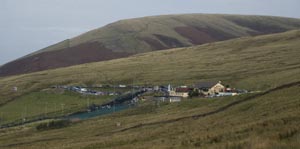
Continue along this track for about 1.5 miles, passing through metal gates, to meet unclassified road. Turn left and follow road up to the Nick of Pendle. If your need for refreshment is pressing, then continue down the doad to the Wellsprings in on left. However, if refreshment isn't required, climb stone stile on left just as the road starts to descend. |
|
Follow path to gateway at other side of rough, enclosed
moorland. Climb another stone stile next to the gate, and follow clear track to right.
As you follow a stone wall on your right, you will pass a gateway with direction signs.
Carry on ahead in the direction of Wiswell.
Although the map indicates that the path goes very close to Wymondhouses, before reaching the buildings there, look out for a wooden marker post close to the stone wall, with footpath marker poining to the left. Follow the marker to another post, then to a stile over stone wall. Cross this stile and head toward depression in field. Follow the direction of this depression, but stay on the left of it. Eventually you have to drop down into the dip, and are faced with a choice of two wooden stiles. Climb the one on the right and follow path down to cross Audley Clough. Climb the bank, bearing right. Cross the field, heading towards distant farm buildings. Climb over a wooden stile, then pass through metal gate. Turn left, then right, pass through another metal gate, then turn left onto unclssified road. |
|
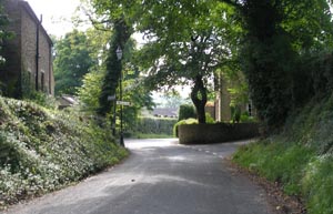
After following the road for about three quarters of a mile, you come to a road junction in Wiswell. Continue ahead to a second road junction, where there is a red telephone box. Turn left up Moor Lane. The road climbs quite steeply for about 300 metres. At the end of the road, follow track through a metal gate. Climb stile by the side of a second metal gate and walk toward ladder stile and gate into woodland. |
|
Continue along path through wood and pass between stone gateposts. The map shows that you should still be in woodland, however the trees had recently been felled when we completed this walk. Climb over a wooden stile, and follow direction of the fence on left. However, as the fence bears to the left, continue ahead to stile in corner of field. Cross this stile to meet outward route. Re-trace your steps down to Spring Wood. |
Back to: