Map: Explorer Sheet 216 - Welshpool and Montgomery
Start: Car park at Snailbeach - SO373022.
This isn't the walk we had planned, nor indeed the walk which we actually did - though we did walk on all the paths described - and it is a route we would recommend. There are steep climbs, and very rough rocky ground underfoot.
Cross the road from the car park, and follow the footpath to the left of the mine road. Cross the road and explore the remains of the lead mine workings. Zig your way up the hill, heading for the Cornish Engine House.
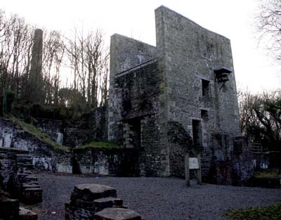
Continue up the hill, with the engine house and associated chimney on your left. The path emerges from the woods, and becomes less steep. Ignore paths to the left and right, continuing uphill until the first outcrop of rock appears on your left (Shepherd's Rock). At a junction of path just beyond this outcrop, turn left. At the next junction of paths, follow the signs downhill for the Shropshire Way. After the path cuts diagonally across a field, leave the Shropshire Way and turn right, following a wide track. The Ordnance Survey map shops Gatten Plantation on the right of this track - however the pines have all been felled, and the regeneration of moorland vegetation is being encouraged. After about a mile the track brings you to The Knolls car park.
Leave the car park via the path on your right, past an information board and through a gate onto the heather moorland. After about a quarter of a mile, take the path on left, leading to the first outcrop, Cranberry Rock.
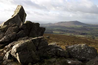
Follow the ridge past Manstone Rock and Devil's Chair (we couldn't recognise a chair in this outcrop. Keep straight ahead where the Shropshire way drops down on the right. Keep Shepherd's Rock (the last outcrop) on your right, and re-trace your original route down to Snailbeach.
Back to:
Walks Index
Graham Dean's Home Page